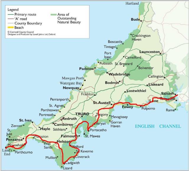
And now all the way to the other side of the country: the south coast of Cornwall.
We spent the first night in Saltash. We chose it only because it was as far as we could get from Southend in one day; the town bills itself as “the gateway to Cornwall” and at first didn’t seem like it had much else to recommend it. But we took a walk around the hilly downtown and a friendly caretaker let us in to have a look at the church.

It’s been through a lot of remodels but parts of St. Stephens & St. Faith church are from the 12th century.
Also there’s a cool Industrial Revolution-era bridge crossing the Tamar River from Plymouth. We stayed at an inn named after the bridge’s architect, Isambard Kingdom Brunel. The fortifying breakfast they gave us in the morning was just the thing for embarking on a road trip.
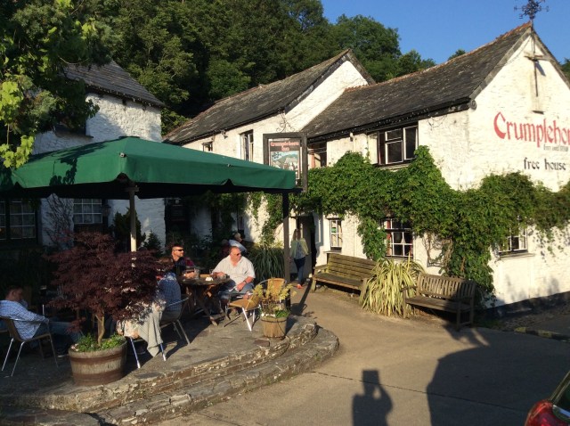
Next stop, the fishing village of Polperro. It’s quite small but very popular so you have to park in a lot outside the village and walk in past Crumplehorn. Although right next door, Crumplehorn is technically a separate village, with a pleasant pub and restaurant in what used to be the old mill.
Polperro gets tourists by the busload. While I can’t say it’s been unchanged by the attention, neither would I call it spoiled. It’s just too pretty for that.
Polperro has a small museum devoted to stories of the smugglers, wreckers, and pirates that were once common on this rugged coast.


We liked the village so much that we booked a room at an inn called the “house on the props,” built from materials salvaged from the wrecked ship “Maverine” in 1700.

The props from whence the inn gets its name
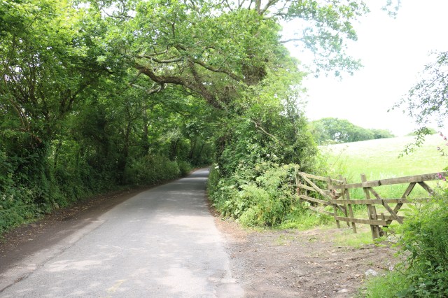
The next day we continued our meander along the southern coast of Cornwall. We travelled mainly on single track roads, meaning that they are only wide enough for one car. Local drivers zip confidently along these paths, beeping their horns on the blind turns. There are periodic wide spots where two cars can pass, but the roads wind so much that I don’t know how anyone can see an oncoming car in time to pull over. When the lane is lined with trees or low stone walls, the only option when two cars meet is for one of them to back up until they find a driveway to pull into. For a right-side-of-the-road- trained driver like myself, this is nerve-racking. Particularly since I couldn’t seem to get used to the width of the car, and so didn’t have a sense of how much room to allow on the left side. Ugh. Pretty as it was, driving was not the fun part of this journey.
But it was worth it for the picturesque fishing villages, with their white-washed, thatched-roof cottages, and their charming little harbors. Cadgwith is just one such village; there were many others.
We continued south from Cadgwith to Lizard and then down to Lizard Point, the southernmost place in mainland Britain.
Heading north again, somewhere in the forest we passed through the village of Gweek.
 Alekka and I cracked ourselves up over ancient Gweeks and Womans, and wondered if there was perhaps a Gweek yogurt factory. Later I learned that Douglas Adams included the village in his book of made-up definitions for British place names, The Meaning of Liff: Gweek (n.) A coat hanger recycled as a car aerial.
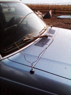
Not seen in Gweek. I stole the picture off the internet but I don’t think the owner will mind.
We checked into a hotel in Penzance for two nights. I’ll cover Penzance in my next post; meanwhile let’s carry on to the end.
We stopped for lunch in Mousehole (word to the wise: it’s pronounced Mowzzle); the tide was out but it was still adorable. And at Janner’s chip shop I had the best fish and chips I’ve have ever had in my life.

Traveling west from Mousehole, I did it: trying to avoid an oncoming truck on a narrow road, I scraped a stone wall on the left side. Brand new rental car, too. I guess that’s why we have insurance (I deleted the photo after I sent it to the carrier; it too depressing to share).
Our final destination was Land’s End. This is the official westernmost point of mainland Britain and the traditional start/finish point for walking and cycling journeys that go from one end of the island to the other (the other endpoint being John O’Groats in Scotland). It was very windy but we had to take a few pictures because that’s what you do here.

Scilly Isles 28 miles – we’re going there next! I chopped it off in the photo, but the right side of the sign says 874 miles to John O’Groats, the other end of Britain.
